Font size
  • A-
  • A
  • A+
Site color
  • R
  • A
  • A
  • A
Skip to main content
If you continue browsing this website, you agree to our policies:
  • TTK Moodle Terms of Use
Continue
x
TTK-Moodle
  • Home
  • Calendar
  • Course manager
  • More
Sitewide search Close
Toggle search input
English ‎(en)‎
Deutsch ‎(de)‎ eesti ‎(et)‎ English ‎(en)‎ Türkçe ‎(tr)‎ Русский ‎(ru)‎ Українська ‎(uk)‎
You are currently using guest access
Log in
TTK-Moodle
Home Calendar Course manager
Expand all Collapse all

Mobility model scetch- task (group)

  1. Practical project activities - GIS and Mobility (IntelTrans)
  2. Week 5- spatial analyzis in QGIS
  3. Mobility model scetch- task (group)
Completion requirements
Opened: Wednesday, 9 February 2022, 12:00 AM
Due: Thursday, 17 March 2022, 11:59 PM

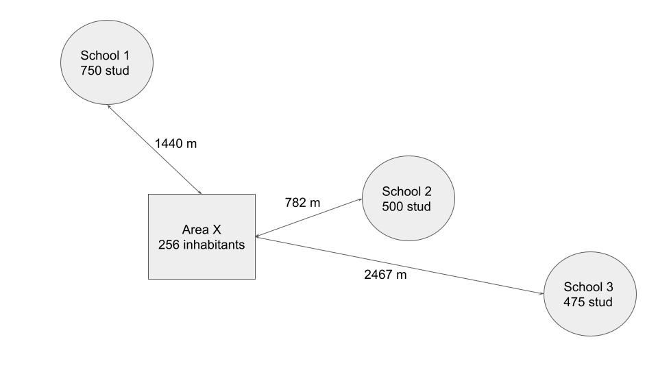
This figure is an example.

Take one particular area from dataset (will found from project files) and visualize distances between schools. Add inhabitants number in area and schools maximum students numbers.

Previous activity Lecture slides- slides
Next activity Self-test

Contact us

Follow us

You are currently using guest access (Log in)
Policies

Get the mobile app

Play Store App Store
Powered by Moodle

This theme was proudly developed by

Conecti.me